PARKSTADEN
SPECULATIVE MASTERPLAN
FOR PARKSTADEN, BRUNNSHÖG
LUND, SWEDEN, 2018
COMMISIONED BY FOLKHEM
BRUNNSHÖG
This speculative masterplan tests and illustrates an experimental, low-rise, sustainable neighborhood, built entirely using timber, on a site owned by Lunds domkyrka. The plan has been prepared for the developer Folkhem.
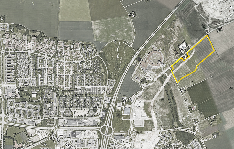
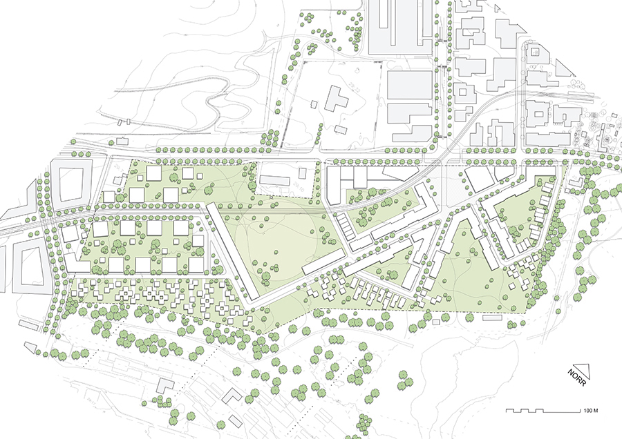
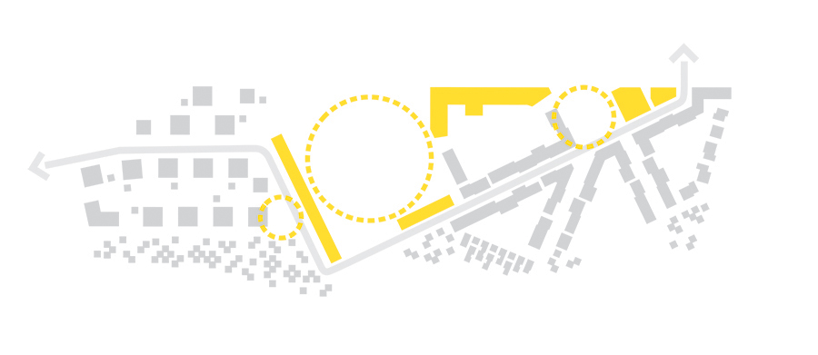
The subject site, Parkstaden, is part of the area of Brunnshög, which is located on the north-eastern periphery of Lund, in the City of Lund municipality in the Skåne Region of Sweden. The construction of the Max IV and ESS scientific research facilities on land to the north of the subject site constitutes the impetus for the development of the area, which is currently in a state of radical transformation, as farmland is being replaced by a new and dense extension of the inner city of Lund. The subject site is at present occupied by open pastures.
THE SITE
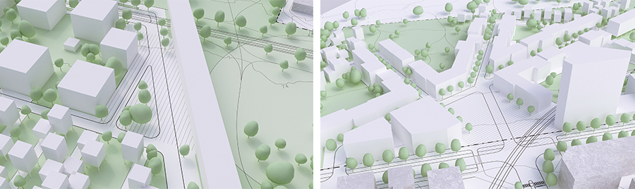
The north-eastern edge of Lund forms a morphological “archipelago” of housing, industrial, and commercial areas, each with their own internal road systems, their own scales, and their own architectural expressions. Each island varies morphologically: modernist slabs (lameller) sit side-by-side post-modern, new-urbanist areas, and tyological experiments punctuate the fabric intermittently .
In contrast, the perimeter blocks that are planned for Brunnshög risk presenting as homogenous and generic, yet another instance of a ubiquitous typology that is being rolled out in new development areas across Sweden. The free-standing villas and row-houses, slab blocks (lameller) and various types of low-rise towers (punkthus) of Lund’s edge zone offer far greater diversity than this planned structure. This critique of the perimeter block, and interest in archipelago-like structures formed a fundamental starting point in our plan for Parkstaden.
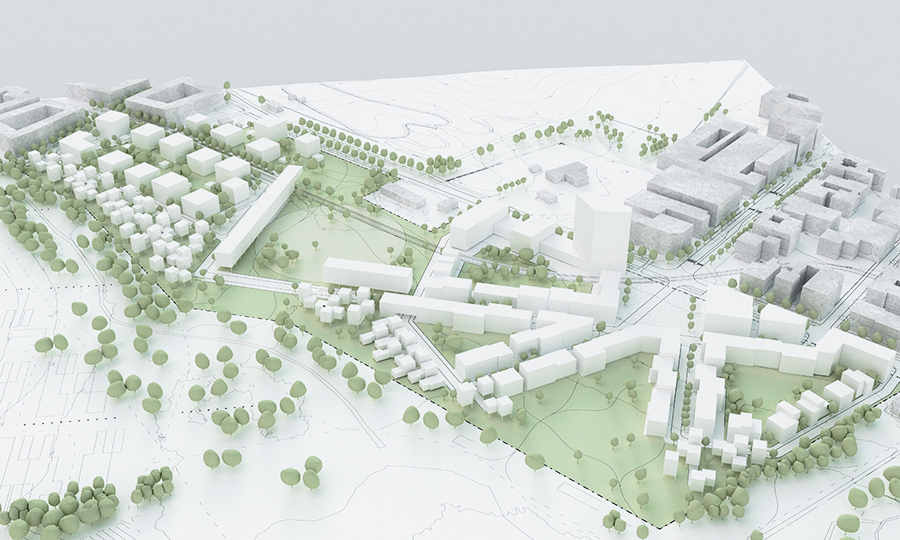
THE PLAN
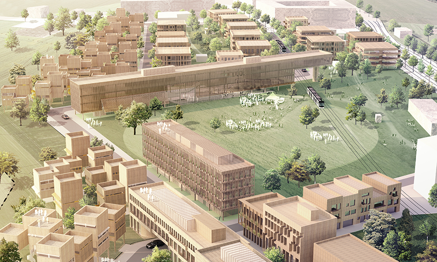
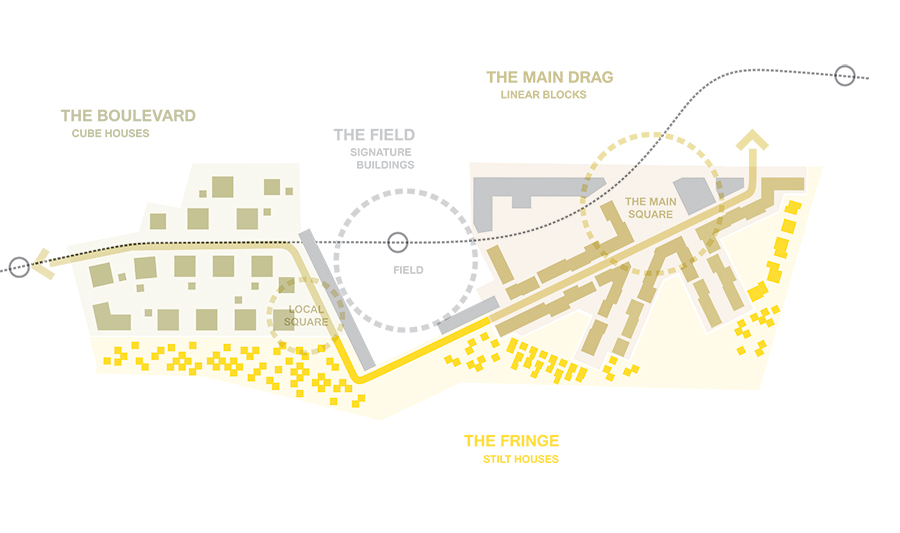
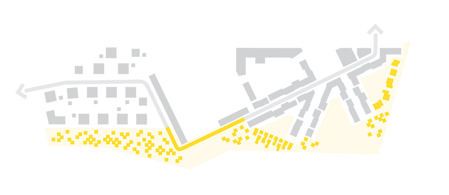
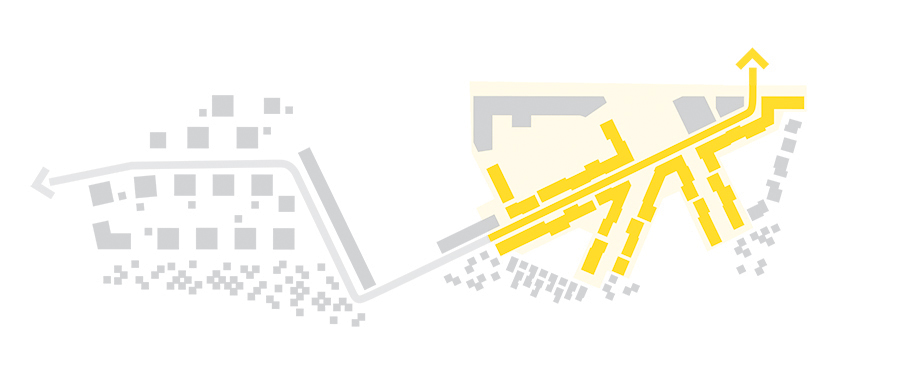
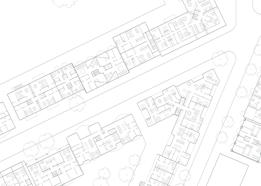
A city is more than a collection of buildings. Linked together in a choreographed sequence, we propose a series of “living environments” (livsmiljöer), each with a distinct character and role to play: (i) the Field is the primary open space around which the plan is structured, and the location of much of the social infrastructure of the neighborhood; (ii) the Boulevard is a wide, tree-lined street framed by generous mixed-use buildings that draw on the generosity of early Swedish modernist architecture; (iii) the Fringe is an area of low-rise dwellings that negotiates the interface with Kunskapsparken to the south and celebrates the rich soils of the area by leaving the ground plain open; and (iv) the Main Drag is a tight urban street that eases the transition towards the higher and more intense development at the Science Village to the north of the site.
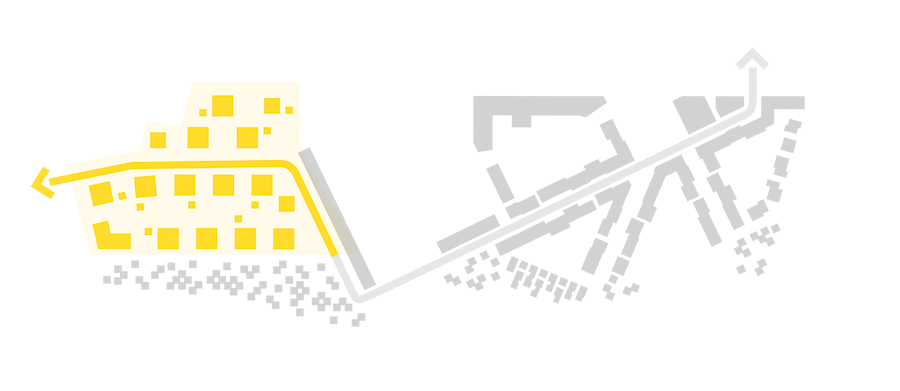
The primary connection for cyclists, pedestrians, and drivers moving through Parkstaden is Brunnshögsvägen. Following the tramline for only part of the length of the site, a kink is introduced into Brunnshögsvägen in order to produce a distinct eastern and southern part of the site. Reflecting the phased development goals of the muncipality's comprehensive plan (FÖP), this division makes room for the social “void” space of the Field.
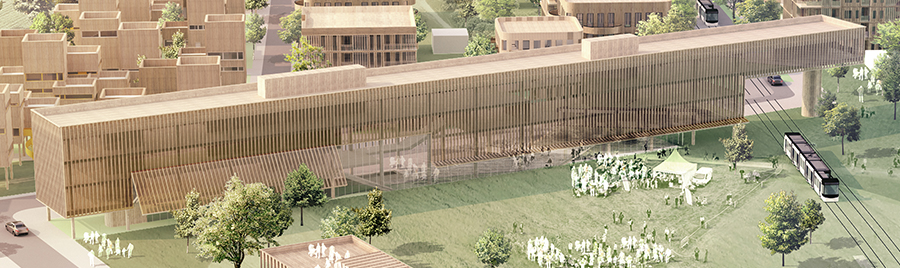
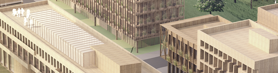
Four Signature Buildings are proposed. These occupy prominent positions on the plan, and hold important social and commercial uses not otherwise accommodated by the low and tight urban fabric of the surrounding areas. Together with the Field and the squares, the Signature Buildings form a public sequence that follows the axis of the tram-line.
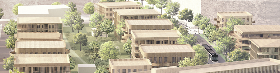
THE BOULEVARD - CUBE HOUSES
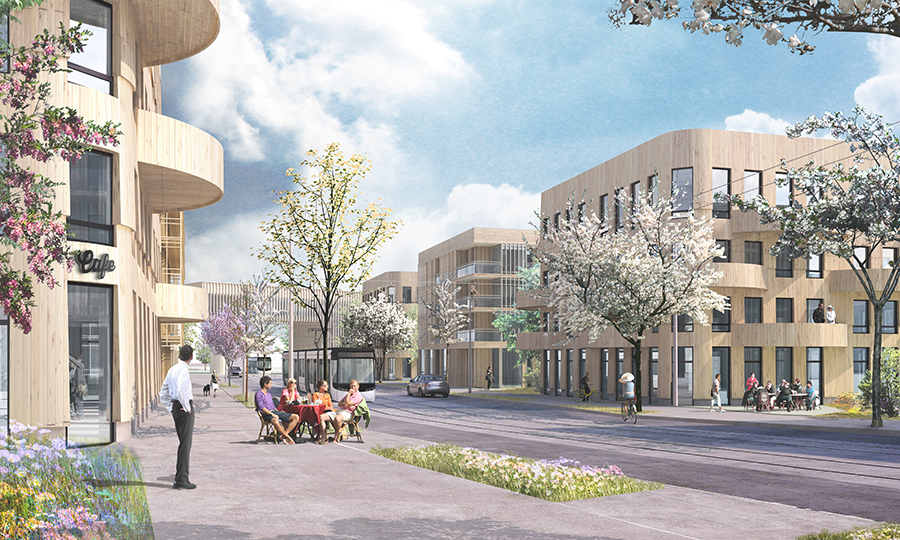
The Boulevard is an area of stately, low-rise, free-standing apartment buildings centered on Brunnshögsvägen. It is structured around a wide and tree-lined thoroughfare that ends in a long community building, which is cantilevered out over the tramline. It is at this point that Brunnshögsvägen shifts direction, heading towards the Local Square. The trees that line the boulevard continue for a small distance following the tramline into the field. Buildings address the street via generous balconies and intricate wooden verandas.
A premium is placed here the possibility of providing light to all four sides of the buildings, by opening up the space to the rear and side of buildings and thereby producing a far more permeable, shared urban environment. In good weather, the space between buildings might be used by cafes, restaurants, small stores, or residents for activities like outdoor dining, street fêtes, cultivation, and bike parking.
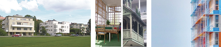
Reference images; left: Askrikegatan, Gärdet (1937), Sturé Frölen (image: cc); middle-left: Traditional Swedish “punschveranda” (image: cc); middle-right: Traditional wood balcony, Tbilisi, Georgia (image: Karin Matz, 2018); right: La Tour Marseillaise (2011) Atelier Jean Nouvel (image: Atelier Jean Nouvel).
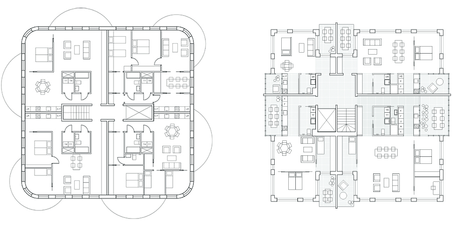
The area of the Boulevard is lined with double rows of Cube Houses. This typology has been designed with reference to Sweden’s architectural history of low-rise towers (punkthus), although the form has been updated in order to respond to contemporary demands for flexibility and a more complex relation to publicness/privateness.
Two version are presented here. In the first variation, Cube House A, a plan is tested which allows for a variation within apartments, as households change in composition in time. In the second variation, Cube House B, a range of different types of loggia make permeable the boundary between interior and exterior space, thickening the interface between the building and the street, and allowing social uses to spill over into exterior spaces in the facade.
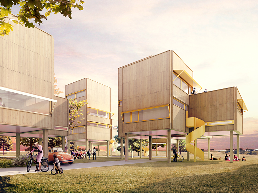
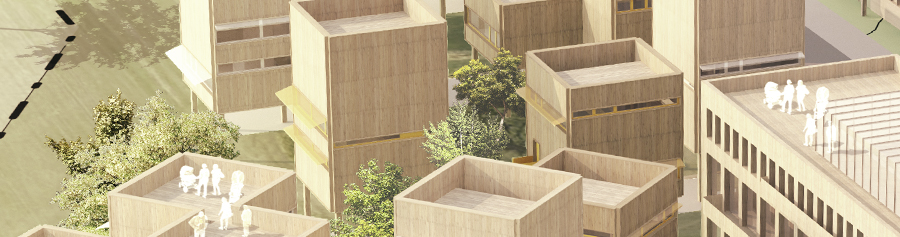
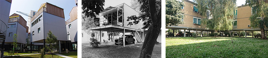
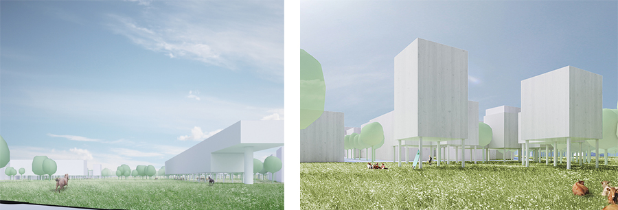
THE FRINGE - STILT HOUSES
The southern part of the Parkstaden site abuts Kunskapsparken, a new recreational area of regional significance. Here, in The Fringe, an open, confetti-like urban fabric is envisaged, where public and private zones are set in vivid relation to one another through an open ground plane.
The use of wood structures and modular CLT panels allows for a light footprint and for buildings to be to be moved at an unknown future time, thereby meeting the planning requirements specifying that 30% of the land that should be able to be returned to open farmland in the future (FÖP).
The fertile soils in this area are to be preserved by lifting the built form up and off the ground. This pedagogically emphasizes the value of the soils, making them part of a daily discussion about the maintenance of a dwelling (“what to do with the ground floor?”); it also maintains views from the northern parts across the site, producing an openness at street level; and it creates a shared ground, in-between the public streets and parks and the domestic interiors of the houses.
Reference images; left: Social housing in Bordeaux (2011) Hondelatte Laporte Architecte (image: http://www.miesarch. com/work/1574); middle: Fritidshus, erik friberger, “Fritiden” exhibition (1936) (image: ArkDes); right: Olympic village, Rome (1960) Luigi Moretti (image: Karin Matz, 2017).
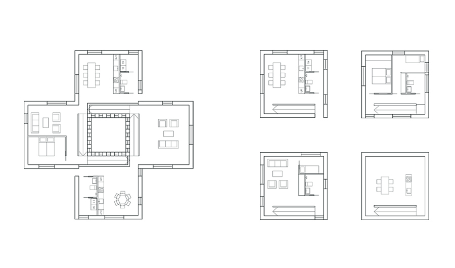
The Stilt Houses are modular in the sense that they can be connected to each other in a variety of ways to create complex dwellings that can be inhabited by more than one person, household, generation, or group of people at a time. In their most complex configuration, the dwellings are arranged around a central “void.” The “+” form of these houses provide for lift access, as well apartments with multiple aspects and good cross-ventilation. A clearly defined sequence of rooms interlock, allowing multiple households to coexist whilst maintaining privacy where desired. This typology is thus particularly suited to intergenerational living, whereby different family groups can maintain their own space in close connection to other units.
THE MAIN DRAG - LINEAR BLOCK
Main streets in Anglo-American contexts are often the product of incrememental growth over time, but can this be planned so as to make use of the street and allow for flexibility in the future? The Main Drag is the section of Brunnshögsvägen which is addressed directly by the Linear Blocks. The area is dense, mixed, and contains the highest concentration of restaurants and commercial premises. It terminates in the Main Square.
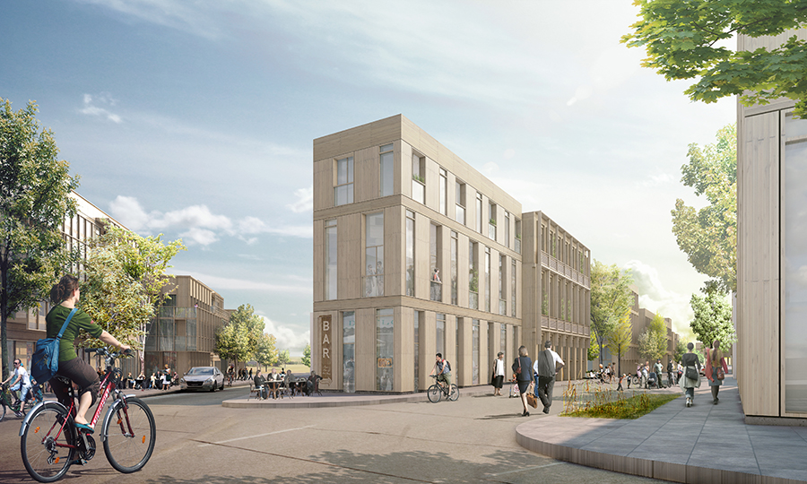
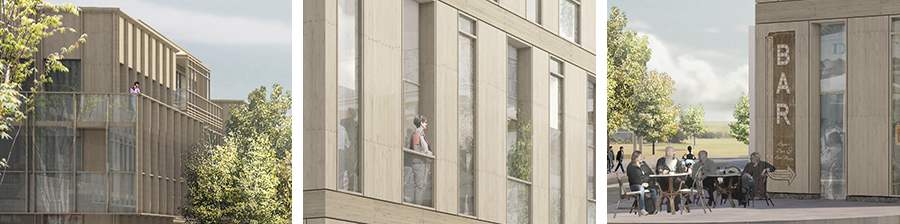
What is a building when it is not a block and not freestanding and not a row-house either? The Linear Blocks abut the streets of the Main Drag. This typology is both familiar and unfamiliar: it offers the opportunity for dual-aspect aapartments, but also apartments that run a considerable length of the building: apartments that become large enough to serve the elderly and assisted living communities, or to provide for rooms that can be rented out; or to accommodate larger-than-normal families. These 3-4 storey buildings would also maintain a vertical diversity by means of allowing for double-height ceiling at both the bottom floor and the second floor, a move that makes possible commercial uses, shopfronts, offices, and grander apartments at both floors, with connections between levels made possible.
THE FIELD, THE SQUARES - SIGNATURE BUILDINGS
The center of the site is dedicated to the Field, which forms the democratic void at the heart of the plan. The name acknowledges the Råängen project (Lunds domkyryka and White Arkitekter) importance in relation on the site. This is a social space, a space for the unforeseen, and a space that holds a memory of the agricultural use of the site. Important community functions abut the Field, with two axial Signature Buildings demarcating its south-western and southern limits.
The rich soils of the Brunnshög area must be respected and maintained where possible. The Field allows a large proportion of the soil of the site to be retained, and even to be sown with various crops that will ensure the maintenance of soil quality. In this way, the Field also provides a substantive space for farming, facilitating cultivation activities at a scale that could in fact feed a community.
Leaving the Field as a large open space also assists in meeting the planning requirements for the site. It effectively compensates in advance for the 30% of the site that needs to comply with “reversible planning” principles set out in the comprehensive plan (FÖP), meaning that the majority of built form in Parkstaden can be built permanently. The Field occupies a section of the site that is not nominated for development before 2030.
Most importantly, the Field is a space for unforeseen events, whether they are festivals or emergency housing, demonstrations or flea markets, community celebrations like midsommar or weddings, or a place to gather in times of crisis.
Four Signature Buildings are proposed. These occupy prominent positions on the plan, and hold important social and commercial uses not otherwise accommodated by the low and tight urban fabric of the surrounding areas.
The first negotiates the transition in the angle of Brunnshögsvägen, bridging the tramline as it passes into the Field. This building is raised on pilotes, and is to house a range of community functions, which could include a healthcare center and the second daycare center required by the comprehensive plan (FÖP), as well as other research and educational facilities.
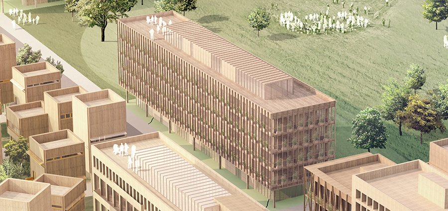
A second Signature Building delineates the opposite (eastern) edge of the meadow, acting as a noise barrier between the Field and housing areas to the east, and as such suitable for non-residential uses including offices and light industrial production facilities and workplaces.
A taller 16-storey tower is positioned at the north-eastern corner of the main square, establishing a dialogue between Parkstaden and Science Village Scandinavia, and expressing an entry point into Brunnshög. Commercial functions can be accommodated in the plinth to the tower, and a mix of uses workshopped, including office, hotel, and residential functions, as well as research facilities which would enjoy a view over both ESS and Max IV.
The final building also abuts the square and is intended to accommodate school and daycare facilities.